Fir Park
Kate Clayton posted on the 31/03/2019 4:54:25 PM
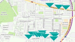
Does anyone know about this bit of neglected land with a sign that says Fir Park, next to firpark terrace.....Is it a community initiative.?
I am a local artist who is interested in proposing a piece of artwork for this space as part of GI next year.
- 11 Replies :
#1 - CV3V replied on the 1/04/2019 2:06:44 PM
The majority of Fir Park is owned and maintained by the council, they cut the grass but that's about it. The farthest north area is privately owned (dont know who by), but its technically outside the park area. A small strip of the park adjacent to Firpark Terrace is owned by the tenement there (likewise the embankment along Ark Lane is owned by the tenements (the upper half of the slope).
The embankment on Ark Lane used have a stone retaining wall along the middle, and Firpark Terrace was much wider. The wall was unstable and had to be knocked down and the slope formed instead, only one small bit remains at the Firpark Terrace / Ark Lane junction.
Part of the park used to be a local quarry, you can still the rock sticking out. Another part of the park used to have tenements on it (you can seem on historic maps). Then someone told me the park used to have a bandstand at some point.
In terms of community benefits etc. you could also approach the developer for the Golfhill Primary School and see it they can assist. The developer had talked about using Fir Park as a play park as compensation for the loss of playing field, but the cash goes to Sport Scotland i think.
Rennie McKintosh used to live on Firpark Terrace, which may also give you some inspiration.
#2 - Kate clayton replied on the 2/04/2019 7:52:39 PM
Hi, thanks so much for this detailed response. Are you referring to the rounded mounds with exposed brickwork as the former quarry?
I view them as burial mounds outside of the Necropolis perimeter wall !
There doesn't seem to be much work going on at the school, do you think it's going ahead?
#3 - The Mentalist replied on the 3/04/2019 11:17:14 AM
I remember when the tenements fell down, I was at St Denis's at the time.
#4 - CV3V replied on the 4/04/2019 5:17:42 PM
There is a planning application lodged for the school and playing fields, its taken a long time to be approved, you can find it on council planning portal - there will be new flats the length of Firpark Street (playing fields side).
I know the mounds you mean, not sure about those (they did things like that in the town i grow up in). There is the exposed rock next to the road, near Firpark Terrace, its getting more and more covered in vegetation - would be nice to see it exposed again.
#5 - Philip lyden replied on the 28/07/2020 4:08:03 PM
I lived in Number 8 Firpark Terrace ( now demolished with Number 7 1983/84)from 1950 to 1962 .
The the terrace is the much the same width as it was in my time there.Ark lane was wider when the wall was there .Also the quarry was inside the Necropolis .
Philip
#6 - Eileen Green replied on the 2/08/2020 1:12:35 AM
The work is definitely going ahead and they have started drilling on the football pitch. The mounts are not burial mounds but just stonework as an architectural gesture to decorate the area. The southern side of the Necropolis was also the quarry and it extended across Firpark, hence 'The Rocks' as the kids called them in days gone by, they sit at the bottom of Firpark street on the corner of Firpark terrace and are mostly covered by weeds. Firpark is so called because it actually was woods at one point, right on the cemetery I believe and it is supposed to have also been the site of Druid worship.
#7 - Philip lyden replied on the 2/08/2020 8:58:01 PM
Eileen is correct the ground in between Firpark Terrace was called (the rocks ) a great play area for us ,there was also 2/3
square air raid shelters .
Also on the corner of Firpark St.and Golfhill School was the original farmhouse .I have a aerial photo of this somewhere .
#8 - The Mentalist replied on the 12/08/2020 11:46:17 AM
Oh, Philip, that would be interesting to see.
#9 - George Welsh replied on the 24/11/2023 10:20:50 PM
I lived at no7 till 1984 ish and left Glasgow. Took my son there recently and it's gone! What happened?
#10 - Barry W Christie replied on the 17/01/2024 12:35:54 PM
Born in 1966 and lived at 8 Firpark Terrace until it was knocked down around 1981 (I believe I was 15 at the time). I reported the big block of stone which had fallen out of the gable end and a few years later part of the outer wall of my bedroom (2nd floor) fell out (you could put your arm out through the hole), which led to massive timber bracing structure beings built down in the back green to stop it collapsing.
Anyway, just want to add a few bits of info and correct some incorrect (I believe) details.
The whole area was part of the Dennistoun estate (I seem to remember), Firpark was specifically named after the Fir trees which formed a park at the top end of Firpark Street/Wishart Street.
Tenements were built on Firpark Terrace (U shaped with ends of U against Necropolis boundary wall) and also two rows in Firpark Street (L shaped with short end of L against Necropolis boundary wall).
I believe there was a proposal for an oval garden next to Firpark Terrace with a 2nd U shaped set of of tenements between that and the tenements further up in Firpark Street, but these were never built.
The Ladywell Quarry was contained within the lower part of the Necropolis and extended upwards (from Tennents brewery) and to the right towards Firpark Terrace, but never exceeded the bounds of the Necropolis ... in fact I believe that 'The Ivy' (as we called it), i.e. the cliff face covered in ivy between the upper and lower parts of the Necropolis is actually the upper edge of the quarry, being formed by the quarrying.
The cliff is all volcanic rock, as are The Rocks on The Hill (as we called them), great to play on apart from all the broken glass.
The retaining wall of Firpark terrace, along the edge of Ark Lane wasn't removed, it had started subsiding and was propped up by large baskets of stone (gabion baskets?) which were then covered in soil, producing the slope which is there to this day ... I think that's when the postbox at the top end of the wall was moved across the road
The mounds with exposed brickwork on the hill, belong to the little folk, they started building there in the late 80's ..... alright we'll go with the boring truth, this was part of landscaping carried out to tame the wild nature of the hill, they added paths and stone mounds, with large timber frames (I think) between the mounds leading to seated areas within the mounds (large blocks of wood).
I remember one huge pinkish concrete structure on the hill and I believed it to be an air raid shelter, but it was filled in when I were a lad.
I really hope they redevelop Golfhill Primary, especially the internal structure of all the landings looking down into the central floor area, with the massive skylight above.
BTW, the maps on National Library of Scotland (maps.nls.uk) are great in that they let you see how areas changed through the years ... the "Bartholomew, John Junior, 1831-1893 " maps shows Firpark Terrace (and proposed garden/tenement), Firpark Street, Ladywell Quarry and of course all the surrounding streets.
#11 - Andrew Ross replied on the 4/04/2024 11:19:38 AM
The name Philip Lyden I know but not a face, anyway others I do remember are Lawson macmillian, Ian Ross( no relation) his parents Charlie and Marion and Jan McCorkadale whose dad was a motorcycle cop and had a Norton 650,a real bike.
You can reply to the post Fir Park by completing the form. No registration required. The forum is moderated in order that messages adhere to the editorial integrity of Dennistoun Online. Please read the guidelines before you submit to the forum. If you believe that we have missed a message that contravenes these guidelines then please contact us and we will either edit or remove it.